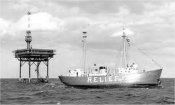
East Coast USCG Lightship/Lightstations
Compiled by K. Elder,
Quality Assurance Coordinator,National Ocean Sciences Accelerator Mass Spectrometry Facility
| Mt. Desert Rock Light Station | 43° 58.1' N 68° 07.7' W | Surface |
| Portland Lightship | 43° 31.6' N 70° 05.5' W | 150 ft 46 m |
| Boston Lightship | 42° 20.4' N 70° 45.5' W | 96 ft 32m |
| Nantucket Shoals Lightship | 40° 33' 00.0'' N 69° 28' 00.0'' W | 192 ft |
| Georges Shoal, Texas Tower #2 | 41° 41' 16.3'' N 67° 45' 36.2'' W | 56 ft |
| Woods Hole | 41° 31'' N 70° 40'' W | Surface |
| Buzzards
Lightship / Buzzards Tower/Light Station |
41° 24' N 71°
03' W 41° 23.8' N 71° 02.1' W |
74 ft 19 m |
| Ambrose Channel Lightship | 40° 27.1' N 73° 49.4' W | 95 ft 29 m |
| Barnegat Lightship | 39° 45.8' N 73° 56' W | 72 ft 24 m |
| Five Fathom Bank Lightship | 38° 47.3' N 74° 34.6' W | 87 ft 24 m |
| Delaware Lightship | 38° 27.2' N 74° 35.1' W | 105 ft 30 m |
| Winter Quarter Lightship | 37° 55.1' N 74° 56' W | 75-96 ft |
| Chesapeake
Light Ship/ Chesapeake Light Station |
36° 58.07'
N 75° 42.2' W 36° 54.3' N 75° 42.8' W |
65 ft 20 m 12 m |
| Diamond
Shoal Lightship / Diamond Shoal Light Station |
35° 5.3'
N 75° 19.7' W 35° 9.2' N 75° 17.8' W |
200 ft 55 m 16 m |
| Frying
Pan Shoals Light Ship/ Frying Pan Shoals Light Station |
33°
28' N 77° 33.1' W 33° 29' N 77° 35.5' W |
62-82 ft 21 m 14 m |
MBLWHOI Library Home Page
Library Privacy Policy
Last updated on June 30, 2005